


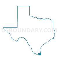
Voting District 0064, Cameron County, Texas
About
Outline

Summary
| Unique Area Identifier | 671366 |
| Name | Voting District 0064 |
| County | Cameron County |
| State | Texas |
| Area (square miles) | 5.59 |
| Land Area (square miles) | 5.58 |
| Water Area (square miles) | 0.01 |
| % of Land Area | 99.89 |
| % of Water Area | 0.11 |
| Latitude of the Internal Point | 26.21697970 |
| Longtitude of the Internal Point | -97.76407270 |
Maps


Graphs
Select a template below for downloading or customizing gragh for Voting District 0064, Cameron County, Texas


Neighbors
Neighoring Voting District (by Name) Neighboring Voting District on the Map
- Voting District 0026, Cameron County, TX
- Voting District 0027, Cameron County, TX
- Voting District 0028, Cameron County, TX
- Voting District 0029, Cameron County, TX
- Voting District 0058, Cameron County, TX
- Voting District 0080, Cameron County, TX
Top 10 Neighboring County Subdivision (by Population) Neighboring County Subdivision on the Map
Top 10 Neighboring Place (by Population) Neighboring Place on the Map
Top 10 Neighboring Unified School District (by Population) Neighboring Unified School District on the Map
- Harlingen Consolidated Independent School District, TX (83,679)
- La Feria Independent School District, TX (15,141)
- Santa Rosa Independent School District, TX (5,225)
Top 10 Neighboring State Legislative District Lower Chamber (by Population) Neighboring State Legislative District Lower Chamber on the Map
Top 10 Neighboring State Legislative District Upper Chamber (by Population) Neighboring State Legislative District Upper Chamber on the Map
Top 10 Neighboring 111th Congressional District (by Population) Neighboring 111th Congressional District on the Map
Top 10 Neighboring Census Tract (by Population) Neighboring Census Tract on the Map
- Census Tract 103.02, Cameron County, TX (8,349)
- Census Tract 104.02, Cameron County, TX (6,683)
- Census Tract 103.01, Cameron County, TX (5,460)
- Census Tract 104.01, Cameron County, TX (5,286)